 Planet Labs Ran AI on a Satellite 500km Up — It Spotted Planes in Seconds
A satellite just stopped being a dumb camera. Now it thinks before it phones home.
$308M revenue. 200+ satellites. $900M contract backlog. 80% detection accuracy. And zero ground stations involved.
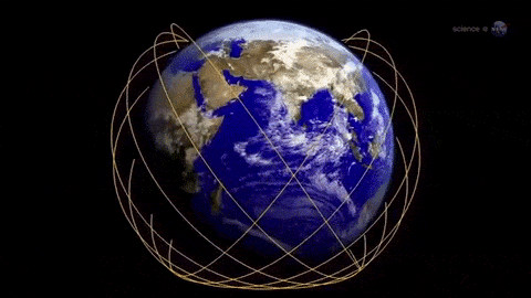
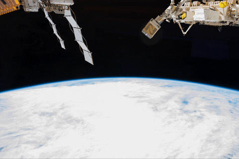
On March 25, Planet Labs’ Pelican-4 satellite flew over Alice Springs, Australia, snapped a photo of an airport, and ran an NVIDIA Jetson Orin AI model to detect airplanes — all while orbiting at 500 km. The whole analysis happened in orbit. No downlink. No waiting hours for ground processing. Just a satellite that looked, thought, and answered. The data shows this is the first time a commercial Earth-imaging satellite has done end-to-end AI inference in space. But here’s the thing nobody mentions: 80% accuracy on raw imagery means 1 in 5 detections is wrong. The model reportedly misidentified a tail section as a separate aircraft’s wings. That’s not deployment-ready — that’s a demo. A very expensive, very impressive demo.
🧩 Dumb Mode Dictionary
| Term | Translation |
|---|---|
| Edge AI | Running the AI brain on the device itself instead of sending data somewhere else to be analyzed |
| Onboard inference | The satellite does the thinking, not a computer back on Earth |
| Jetson Orin | NVIDIA’s tiny GPU module — like a gaming graphics card shrunk to fit inside a satellite |
| GeoTIFF / GeoJSON | File formats that say “here’s a picture” and “here’s exactly where on Earth that picture is” |
| Binned chips | Chips that didn’t pass quality control for their original purpose, repurposed for cheaper products |
| Pelican | Planet’s newest satellite line — higher resolution, AI-enabled, the flagship |
| Downlink | Beaming data from space to a ground station. Costs money. Takes time. The bottleneck. |
📰 What Actually Happened
- March 25, 2026: Pelican-4, orbiting at ~500 km, captured imagery of Alice Springs airport
- The onboard NVIDIA Jetson Orin module ran an object detection model within moments of capture
- It identified airplanes on the tarmac and generated GeoTIFF and GeoJSON outputs
- The entire pipeline — image capture, AI detection, geo-rectification — ran in isolated Docker containers. In space.
- Traditional workflow: capture → downlink raw data → wait hours → ground processing → deliver. New workflow: capture → process onboard → deliver insights in minutes
- Planet calls this “Planetary Intelligence at scale”
📊 Planet Labs By the Numbers
| Metric | Number |
|---|---|
| Revenue (FY2026) | $307.73M (+26% YoY) |
| Q4 Revenue | $86.82M (beat consensus by $8M) |
| Total Backlog | $900M |
| Adjusted EBITDA | $15.5M (first profitable year) |
| Fleet Size | 200+ satellites (largest imaging fleet on Earth) |
| Biggest Deal | $230M with SKY Perfect JSAT |
| German Defense Contract | €240M |
| MDA SHIELD Contract Ceiling | $151 billion |
| Stock (NYSE: PL) | ~$27, analyst target $24.34 |
| Pelican Resolution | 40-50cm (Gen 1), 30cm (Gen 2, coming late 2026) |
But here’s the thing nobody mentions: that $151B SHIELD contract ceiling doesn’t mean Planet gets $151B. It means they’re eligible to bid on pieces of a pot worth up to that much. The actual dollars flowing to Planet from that vehicle? TBD.
🔍 The Accuracy Problem
80% on raw imagery sounds like a passing grade. It’s not.
In satellite intelligence, a false positive means you scramble a response team for a shadow. A false negative means you miss the thing you were looking for. At scale — hundreds of images per orbit, dozens of orbits per day — an 80% rate generates thousands of incorrect detections daily.
Planet says this is an initial demonstration. The model will improve. And they’re right — edge AI models get better with more training data, and Planet captures the entire Earth’s landmass every 24 hours. That’s a training dataset most AI companies would commit crimes for.
But here’s the counterargument: ground-based processing with bigger models and human verification already achieves 95%+ accuracy. The question isn’t “can you run AI in space?” — it’s “is the speed-accuracy tradeoff worth it?” For disaster response, probably yes. For military targeting, probably not yet.
🏢 Who's Competing for Space AI
Planet isn’t the only company putting brains on birds:
- BlackSky (BKSY): Launched 6 edge-computing satellites in 2023. Their Spectra AI platform mixes imagery with news and social media feeds. Direct competitor.
- Maxar Technologies: Integrated AI analytics into WorldView constellation in early 2025. Higher resolution (30cm), but smaller fleet and less frequent revisits.
- Capella Space: SAR (radar) imagery — works through clouds and at night. Partnered with U.S. DoD in 2024. Different tech, same defense buyers.
- Satellogic: Argentine startup, 25cm resolution, cheaper pricing. Aiming at the budget end.
- Airbus Defence & Space: European heavyweight. Decades of archive data. Moving slower on edge AI but has the government contracts.
The Earth observation market is projected at 8.3% CAGR through 2034. U.S.-based companies (Maxar, Planet, BlackSky) control 52% of North American commercial imagery revenue.
🗣️ What People Are Saying
“By integrating the NVIDIA Jetson platform directly onboard, we are effectively adding a high-functioning AI ‘brain’ to our satellite ‘eyes.’” — Will Marshall, Planet Labs CEO
“This success is a glimpse into the future of what we call Planetary Intelligence at scale.” — Kiruthika Devaraj, VP of Avionics & Spacecraft Technology
“The AI misidentified a tail section as wings of a separate aircraft.” — Commenter on the detection results (the internet keeps it honest)
Planet also indefinitely suspended satellite imagery of Iran and the broader Middle East at the U.S. government’s request — showing exactly how politically loaded this data is.
⚙️ Why This Matters Beyond the Demo
The real bottleneck in satellite intelligence has never been the cameras. It’s the pipe.
A single high-resolution satellite generates terabytes of imagery per day. Downlinking all of that to ground stations takes bandwidth, costs money, and creates a hours-long delay. Most of that data is ocean, clouds, or empty desert — useless.
Running AI onboard means the satellite can decide what’s worth sending. Instead of downloading 10 TB and having a ground team sift through it, the satellite sends a 500-byte JSON file that says “3 aircraft detected at coordinates X, Y at timestamp Z.”
That’s not just faster. It’s orders of magnitude cheaper on bandwidth. And it means you can task a satellite to watch for something specific — say, ships entering a port, or construction activity at a military site — and only phone home when it sees something.
The defense implications are obvious. The commercial ones are bigger. Insurance companies tracking crop damage in real time. Logistics firms monitoring port congestion. Energy companies verifying pipeline activity. All getting answers in minutes instead of days.
Cool. A satellite just grew a brain. Now What the Hell Do We Do? (⊙_⊙)
📊 Build a Geospatial Analytics Dashboard for SMBs
Planet’s API is publicly accessible with tiered pricing. Most small businesses and local governments can’t afford to hire geospatial analysts but they desperately need this data — construction monitoring, agricultural assessment, insurance verification. Build a vertical SaaS tool that wraps Planet’s API with a simple dashboard for a specific industry.
![]() Example: A solo dev in Nairobi built a crop-monitoring dashboard for East African smallholder farmers using Planet’s daily imagery API and simple NDVI calculations. Sold monthly subscriptions at $15/farmer to 400 cooperatives through a local ag-tech accelerator. Hit $6K MRR within 5 months.
Example: A solo dev in Nairobi built a crop-monitoring dashboard for East African smallholder farmers using Planet’s daily imagery API and simple NDVI calculations. Sold monthly subscriptions at $15/farmer to 400 cooperatives through a local ag-tech accelerator. Hit $6K MRR within 5 months.
Timeline: 2-3 months to MVP, 6 months to first revenue
🔧 Sell Edge AI Model Optimization for Satellite Hardware
NVIDIA Jetson Orin is powerful but constrained — limited memory, limited power, limited thermal headroom in space. The companies building satellite AI need people who can squeeze maximum accuracy out of minimum compute. Model pruning, quantization, knowledge distillation — these are skills that transfer directly from mobile AI optimization.
![]() Example: A machine learning contractor in Bangalore specialized in TensorRT optimization for Jetson modules. Got a $45K contract from a European satellite startup to shrink their detection model from 2.1GB to 340MB while maintaining 92% accuracy. Now has three satellite clients and a waiting list.
Example: A machine learning contractor in Bangalore specialized in TensorRT optimization for Jetson modules. Got a $45K contract from a European satellite startup to shrink their detection model from 2.1GB to 340MB while maintaining 92% accuracy. Now has three satellite clients and a waiting list.
💰 Trade the Earth Observation Sector
Planet Labs (PL), BlackSky (BKSY), and Satellogic (SATL) are all publicly traded. The sector is small-cap and volatile — PL moved 8% on a single earnings beat. Major catalysts ahead: Gen 2 Pelican launches, potential new defense contracts, and the broader push toward “real-time Earth intelligence.” This isn’t financial advice, but the data shows a sector with 26% YoY revenue growth, first-time profitability, and a $900M backlog that hasn’t been priced in yet by most retail investors.
![]() Example: A part-time trader in Warsaw tracked Planet Labs’ SEC filings and noticed the MDA SHIELD contract announcement before mainstream financial media picked it up. Bought PL at $19, sold at $27 after the Q4 earnings pop. $8K profit on a $19K position in 6 weeks.
Example: A part-time trader in Warsaw tracked Planet Labs’ SEC filings and noticed the MDA SHIELD contract announcement before mainstream financial media picked it up. Bought PL at $19, sold at $27 after the Q4 earnings pop. $8K profit on a $19K position in 6 weeks.
🛡️ Offer OSINT Services Using Commercial Satellite Feeds
Open-source intelligence analysts are in massive demand — from journalism to corporate due diligence to NGO conflict monitoring. Planet’s imagery, combined with tools like SentinelHub and Google Earth Engine, lets individuals build professional-grade monitoring capabilities. The gap: most organizations that need this can’t do it themselves.
![]() Example: A former GIS analyst in Lisbon started a boutique OSINT consultancy offering satellite-based supply chain verification for European ESG compliance teams. Using Planet and Sentinel-2 data, she verifies deforestation-free sourcing for three food importers. Charges €3,500/month per client, running at €10.5K MRR with zero employees.
Example: A former GIS analyst in Lisbon started a boutique OSINT consultancy offering satellite-based supply chain verification for European ESG compliance teams. Using Planet and Sentinel-2 data, she verifies deforestation-free sourcing for three food importers. Charges €3,500/month per client, running at €10.5K MRR with zero employees.
🎓 Create a Course on Satellite AI and Geospatial ML
The intersection of AI and satellite imagery is growing fast but the talent pipeline is thin. Most ML engineers don’t understand orbital mechanics, sensor characteristics, or geospatial data formats. Most remote sensing experts don’t know PyTorch. A course bridging this gap — especially one focused on edge deployment for constrained hardware — would fill a real market need.
![]() Example: A PhD dropout in São Paulo created a 12-module Udemy course called “Satellite AI: From Raw Imagery to Edge Deployment” covering YOLO on Jetson, GeoTIFF processing, and Planet API integration. Priced at $49, sold 2,800 copies in 8 months. Supplemented with a $200/month Discord community with 340 members. Total: ~$205K revenue.
Example: A PhD dropout in São Paulo created a 12-module Udemy course called “Satellite AI: From Raw Imagery to Edge Deployment” covering YOLO on Jetson, GeoTIFF processing, and Planet API integration. Priced at $49, sold 2,800 copies in 8 months. Supplemented with a $200/month Discord community with 340 members. Total: ~$205K revenue.
🛠️ Follow-Up Actions
| Want To… | Do This |
|---|---|
| Access Planet’s data | Sign up at planet.com/explorer — free tier available for research |
| Learn Jetson AI optimization | NVIDIA’s Jetson AI Lab has free tutorials and pre-trained models |
| Track satellite stocks | Set alerts for PL, BKSY, SATL earnings and contract announcements |
| Build OSINT skills | Start with Bellingcat’s free online investigation toolkit |
| Understand geospatial ML | Google Earth Engine + Planet’s developer docs are free and excellent |
![]() Quick Hits
Quick Hits
| Want… | Do… |
|---|---|
| Build on Planet’s API — pricing starts at $0 for research access | |
| Learn TensorRT + Jetson — satellite companies are hiring now | |
| Watch PL, BKSY, SATL — small caps with defense upside | |
| Combine Planet + Sentinel-2 for commercial monitoring services | |
| Planet’s developer docs + NVIDIA Jetson Academy — both free |
A satellite just decided what was interesting before anyone on Earth asked. That’s not a camera upgrade — that’s the beginning of autonomous observation. And the data says we’re not ready for what comes next.
 !
!